The selection of a site for a nuclear power plant, in accordance with the requirements of the International Atomic Energy Agency (IAEA) and the regulatory documents of the Russian
Federation, is the first and most
fundamental stage.
To assess the site and choose
the location for a nuclear power plant,
engineers conduct surveys that allow them
to thoroughly analyze natural conditions and man-made factors, and to evaluate the potential environmental impact of the plant on the region.
The main on-site surveys include the following:
- Engineering and geodetic survey;
- Engineering and geological survey, including hydrogeological,
geophysical, and seismological research;
- Engineering and hydrometeorological survey;
- Engineering and environmental survey;
- Engineering and geotechnical survey.
Based on the engineering surveys, a potential site evaluation will be conducted, and a preferred site will be determined for the construction of a nuclear power plant.
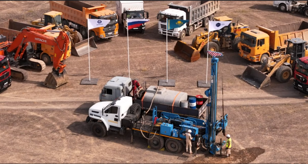
At least 100 experts will be involved in the engineering survey process, at both field sites and in
specialized laboratories and offices..
At least 50 boreholes are planned to be
drilled, each with a depth ranging from
30 and 120 meters in order to obtain accurate geological
and lithological data, tocollect soil and water samples, and to study physical and mechanical properties of the soil. This will involve conducting
a comprehensive range of geophysical and
geotechnical studies in the boreholes.
In addition, it
is planed to evaluate the feasibility
of using local construction materials as well as gravel and sludge, to assess
external human impacts,to perform a year-long
monitoring studies of site parameters in order to determine background environmental indicators, and to
collect information about groundwater sources for potential water supply.
The work will involve the use of specialized software, equipment and
devices including cutting-edge high-precision geodetic instruments; radioactive and seismic surveying systems; equipment for in-situ soil
deformation measurements; equipment for measuring soil deformation directly in the massif; and specialized laboratory equipment.
A network of monitoring investigations
will be arranged in the survey
area. This includes seismic and meteorological stations, aerological equipment,
hydrological stations, hydrogeological and piezometer wells, and geodynamic monitoring equipment.
In total, the surveys will take 18 months to complete.